Search and Rescue Drones: A Guide to How SAR Teams Use Drones in Their Work
BY Zacc Dukowitz
14 June 2024A search and rescue drone (or SAR drone) is any drone used by search and rescue teams in their operations.
Credit: Skydio
Among all the ways public safety agencies use drones, search and rescue is the oldest—and was probably the first way ever imagined.
While drones were first proposed for firefighting in 2011, using drones in search and rescue was proposed way back in 2001. That year, the idea of SAR drones swept through several aviation and robotics conferences.
Despite its potential, the idea of deploying drones for search and rescue seemed pretty ambitious in those early days. It was unclear if drone technology was actually advanced enough to locate missing people, and to deal with the rugged conditions—poor GPS, flight in rain, at night, or in extremes of heat and cold—they’d face.
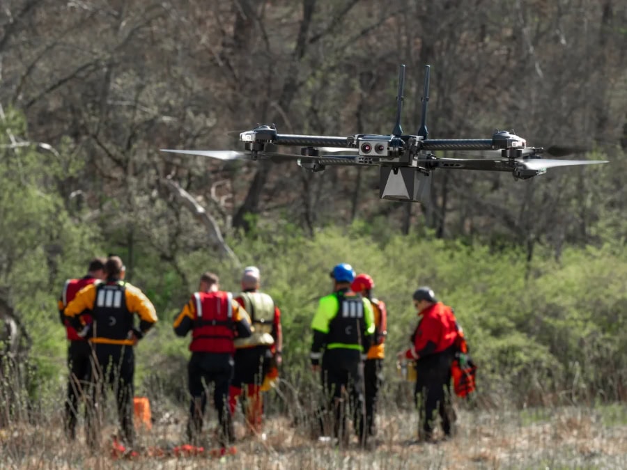
But today we know that search and rescue drones are one of the most common, and most useful, ways that first responders use drones in their work.
In this in-depth guide to drones in search and rescue we’ll cover what a SAR drone is, the top models on the market, and some of the top use cases for rescue drones, as well as several other topics related to search and rescue drones.
Here’s a menu in case you want to jump around:
- What Is a SAR Drone?
- A Brief History of Drones in Search and Rescue
- What Kinds of Drones Do SAR Teams Use? The Top Search and Rescue Drones on the Market
- How Are SAR Drones Used? The Top 15 Applications for Drones in Search and Rescue
- SAR Drones: Case Studies and Real-World Examples
- The Future of Drones in Search and Rescue
What Is a SAR Drone?
Today SAR drones, also known as search and rescue drones, are indispensable tools for emergency response teams worldwide.
These drones are not just high-tech gadgets, but critical assets that enhance the capabilities of search and rescue teams by providing aerial data that is otherwise almost impossible to obtain.
SAR drones provide a bird’s-eye view that is invaluable during emergencies. They can quickly cover large areas, reach inaccessible locations, and provide critical information that can guide search and rescue efforts.
How Are SAR Drones Used?
Here are the main ways that drones are used for rescue operations:
- Aerial reconnaissance. Offering real-time aerial views to locate missing persons and assess the situation in disaster areas, using both visual and thermal data.
- Aerial thermal imaging for search operations. Using thermal cameras to detect heat signatures from people, even in low-visibility conditions like smoke, fog, or darkness.
- Delivery of emergency supplies. Transporting medical supplies, food, and other essentials to individuals stranded in remote or hazardous areas.
- Real-time damage assessment. Providing detailed imagery to help assess damage and guide response efforts in natural disasters or accidents.
What Makes a Search and Rescue Drone?
There aren’t any drones made specifically for search and rescue,
But there are lots of high-quality professional drones on the market made with advanced features that cater to the unique demands of SAR operations.
SAR drones vary widely in size and capability, from compact quadcopters that are easy to deploy and maneuver in tight spaces, to larger, more robust hexacopters that can carry heavier payloads and operate for extended periods.
Despite these variations, SAR drones generally share some common characteristics:
- Advanced sensors and cameras. Equipped with high-resolution visual and thermal cameras, SAR drones can capture detailed imagery and detect heat signatures. These features are essential for locating missing persons, identifying hazards, and assessing damage in disaster-stricken areas.
- Real-time communication systems. These drones often feature real-time video streaming capabilities, enabling search and rescue teams to monitor live footage from the drone, communicate with operators, and make informed decisions quickly.
- Rugged design. SAR drones are built to withstand harsh environmental conditions. They can operate in extreme temperatures, high winds, and challenging terrains, ensuring reliable performance during critical missions.
Want to Start a Public Safety Drone Program?
Here are some resources to help you get started:
- Applying for a Public COA vs. Part 107 Certification for Police and Fire Departments
- A Drone Pilot’s Guide to Tactical BVLOS (TBVLOS) Waivers for Public Safety Agencies
- Master List of Drone Laws (Organized by State)
- Drone License: A Step-by-Step Guide to FAA Part 107 Certification for U.S. Commercial Drone Pilots
This article is part of a series on drones in public safety. Here are the other articles in the series:
- What Is a Public Safety Drone?
- Police Drones: A Guide to How Law Enforcement Uses Drones in Its Work
- Firefighting Drones: A Guide to How Fire Departments Uses Drones in Their Work
- Drone as a First Responder: A Guide to DFR Programs and First Responder Drones
A Brief History of Drones in Search and Rescue
As we mentioned above, the concept of using drones for search and rescue can be traced back to the early 2000s.
Initial discussions in the first responder community focused on using military-grade UAVs for SAR missions, given their advanced capabilities in aerial surveillance and navigation.
But these drones are expensive and specialized, which meant that early efforts were limited by both the high costs of the technology and complexity of using it.
A major breakthrough for drones in SAR came in 2005, when the International Association for Search and Rescue Robotics (IASAR) was founded.
IASAR is devoted to advocating for the use of robots and drones in rescue operations, and it’s helped pave the way for the acceptance and integration of UAVs in SAR scenarios by demonstrating their potential to save lives and reduce risk to human rescuers.
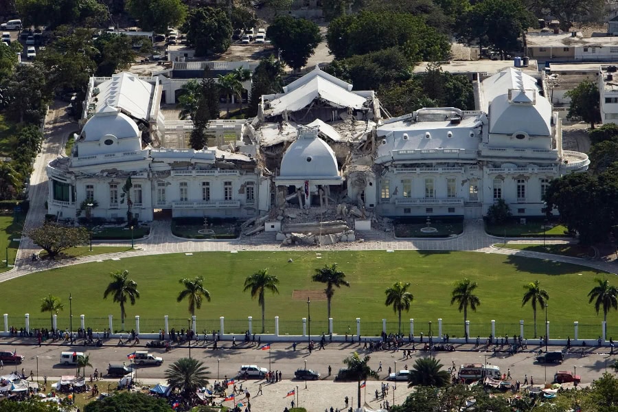
The National Palace in Port-au-Prince, Haiti following the 2010 earthquake | Credit: Logan Abassi/UN Photo
Five years later, drones were first deployed to help in SAR efforts in 2010 in Haiti following a devastating earthquake.
From there, drone technology has advanced rapidly and the use of drones in SAR work has grown alongside it—check out the list of milestones below for an overview of how drones have been adopted throughout search and rescue work over the last 25 years.
Major Milestones in the Evolution of Drones for Search and Rescue
- 2001. The concept of using UAVs for search and rescue is proposed at several aviation and robotics conferences, highlighting the potential for aerial platforms in emergency scenarios.
- 2005. The International Association for Search and Rescue Robotics is founded, promoting the use of drones and robots in rescue operations. This organization played a crucial role in advocating for the integration of UAVs in search and rescue missions. (IASRR is no longer active.)
- 2010. UAVs are successfully deployed for the first time in a major SAR operation during the aftermath of the Haiti earthquake, where they provided critical aerial imagery to aid in disaster response and recovery .
- 2013. Texas A&M University Robotics program uses drones in response to the Moore, Oklahoma tornado. This marks one of the first significant uses of drones for SAR in a disaster scenario, setting a precedent for their utility in emergency response .
- 2017. Drones are extensively used in the search and recovery operations following Hurricanes Harvey and Irma, demonstrating their value in large-scale disaster management and response efforts .
- 2019. Non-profit DRONERESPONDERS is established, aimed at connecting, training, and educating first responders and SAR specialists on the effective use of drones in emergency operations .
- 2021. The FAA grants the first Beyond Visual Line of Sight (BVLOS) waiver specifically for SAR operations, enhancing the capabilities of drones to operate over larger areas and in more complex environments (UAV Coach).
- 2023. Over 500 search and rescue teams across the United States are reported to be using drones, reflecting the technology’s widespread adoption and critical role in modern SAR operations.
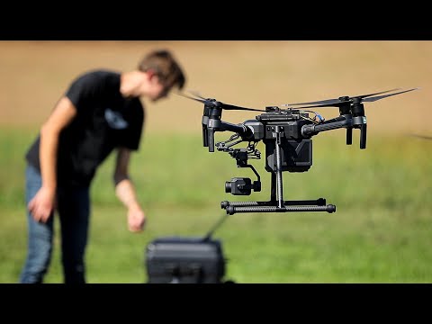
Credit: DJI
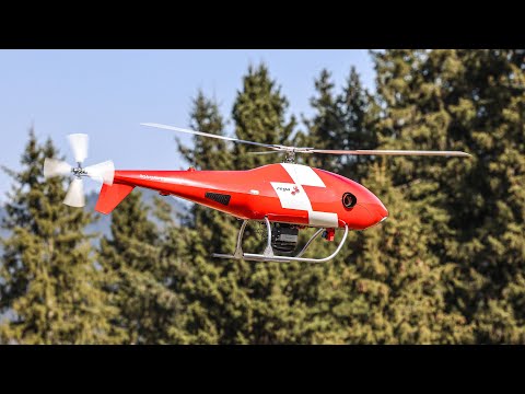
What Kinds of Drones Do SAR Teams Use? The Top Search and Rescue Drones on the Market
As we’ve covered, there aren’t any drones made specifically for search and rescue. But there are several professional drones that are ideal for SAR—here’s our list of the top five on the market.
1. Skydio X10

- Price range. $$$
- Top police use cases. Autonomous navigation, obstacle avoidance, real-time video streaming, and search in GPS-denied environments.
- Supply chain information. Made in the USA, NDAA-compliant, on Blue UAS list.
Top Features
- Autonomy. Advanced AI for obstacle avoidance and autonomous navigation.
- Flight time. 45 minutes.
- Transmission range. Up to 7.5 miles with Skydio Connect SL.
- Payload capacity. Supports multiple payloads, including high-resolution cameras and thermal sensors.
- Advanced features. NightSense for zero-light navigation and AI-powered obstacle avoidance, making it ideal for complex and confined environments.
2. FLIR SIRAS
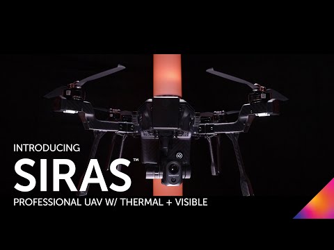
- Price range. $$
- Top SAR use cases. Thermal imaging, search and rescue, hazardous material assessment, and disaster response.
- Supply chain information. Made by Teledyne FLIR, with assembly in the USA, making it NDAA-compliant.
Top Features
- Flight time. 31 minutes.
- Transmission range. 9.3 miles (15 km).
- Payload capacity: Interchangeable payload system with a 640×512 radiometric thermal camera and a 16MP visual camera.
- Durability. IP54 rating, suitable for operations in extreme temperatures and windy conditions.
3. Parrot ANAFI USA

- Top SAR use cases. Thermal imaging, search and rescue in remote areas, and situational awareness.
- Price range. $$
- Supply chain information. Made in the USA and France, NDAA-compliant.
Top Features
- Flight time. 32 minutes.
- Transmission range. 4 km with strong signal stability.
- Camera system. Dual 21 MP cameras with 32x zoom, FLIR Boson 320 x 256 IR camera.
- Payload capacity. Lightweight design with a 32x zoom visual camera and a FLIR Boson thermal camera.
- Durability. IP53 rating for dust and water resistance.
4. DJI Matrice 350 RTK
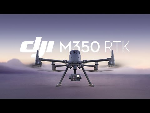
- Price range. $$$
- Top SAR use cases. Aerial reconnaissance, thermal imaging, search and rescue, disaster response, and high-precision mapping.
- Supply chain information. Manufactured by DJI in China, making it not NDAA-compliant.
Top Features
- Flight time. 55 minutes, enabling prolonged operations essential for extensive search and rescue missions.
- Transmission range. Up to 15 km, providing reliable long-distance communication and control for wide-area search operations.
- Payload capacity. Supports up to 2.7 kg, compatible with various advanced payloads including the Zenmuse H20T, which integrates thermal imaging, a visual camera, and a laser rangefinder.
- Durability. IP55 rating for robust protection against dust and water, capable of withstanding extreme weather conditions and wind speeds up to 12 m/s.
5. Autel Robotics EVO II Dual 640T
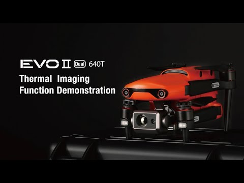
- Top police use cases. Search and rescue, surveillance, thermal imaging for night ops.
- Price range. $$
- Supply chain information. Made by Autel Robotics, a Chinese-American company, making it not NDAA-compliant.
Top Features
- Flight time. 40 minutes.
- Transmission range. 9 km.
Payload capacity. Includes a dual-sensor payload with an 8K visual camera and a 640×512 thermal camera. - Durability. IP43 rating, designed for rugged environments, making it suitable for operations in a range of weather conditions.
How Are SAR Drones Used? The Top 15 Applications for Drones in Search and Rescue
SAR drones have become indispensable in emergency response scenarios due to their versatility and advanced capabilities.
Here are the top 15 most common applications for drones in search and rescue operations.
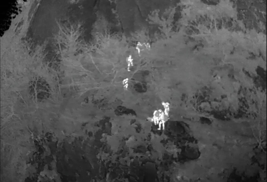
Image from a thermal drone used to find missing people at night
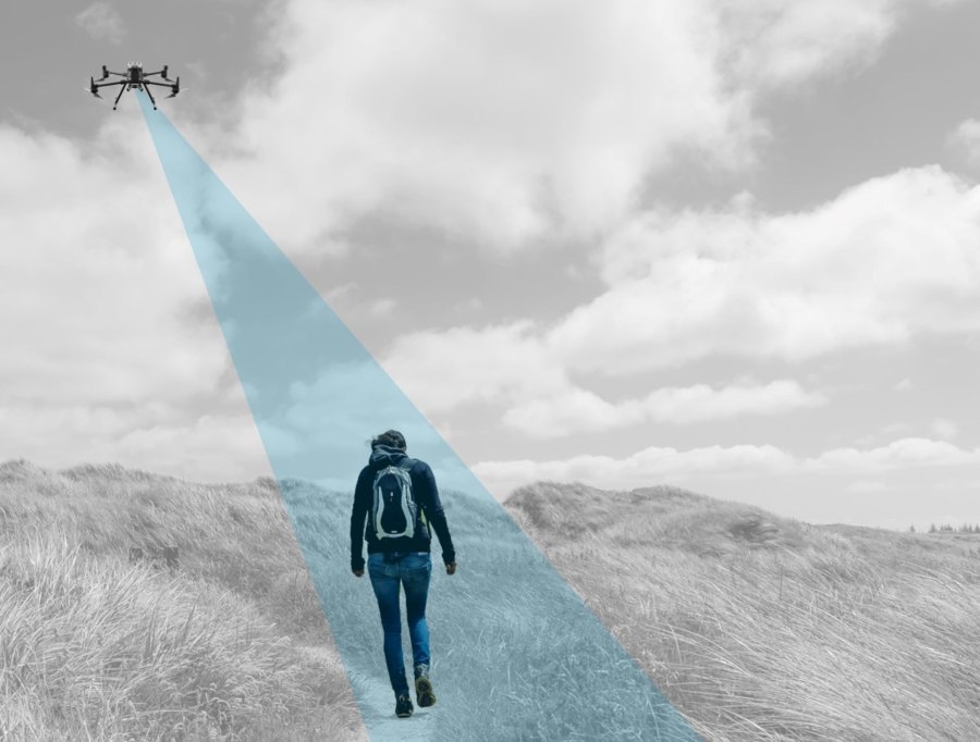
1. Aerial Surveillance and Reconnaissance
SAR drones provide real-time aerial views of large areas, helping teams to monitor disaster scenes, track the movement of individuals, and gather critical information without being on the ground. This capability is essential for situational awareness and effective decision-making in complex environments (DroneDJ).
2. Thermal Imaging for Victim Location
Equipped with thermal cameras, SAR drones can detect heat signatures from humans and animals in low-visibility conditions such as smoke, fog, or darkness. This application is crucial for finding missing persons in wilderness areas or during nighttime operations (DroneDJ) (FLIR).
3. Disaster Assessment
Drones can quickly assess damage after natural disasters like earthquakes, hurricanes, or floods. They provide high-resolution images and data to help emergency responders evaluate the extent of the damage and prioritize areas for immediate attention.
4. Flood Monitoring and Response
SAR drones are used to monitor rising water levels, identify at-risk areas, and guide rescue operations during floods. They provide vital information to coordinate evacuation efforts and deliver supplies to isolated communities (FLIR).
5. Search in Rough Terrain
Drones equipped with GPS and mapping capabilities can efficiently search large, rugged terrains that are difficult for ground teams to navigate. This includes forests, mountains, and other challenging landscapes (FLIR) (FLIR).
6. Mapping and Surveying
SAR drones create detailed maps of disaster areas, providing a clear overview of the terrain and helping teams plan their operations effectively. These maps are crucial for coordinating search efforts and assessing the most affected regions (UAV Coach).
7. Underwater Search and Recovery
Specialized drones can operate underwater to search for missing persons, recover evidence, or inspect submerged structures. These drones are equipped with cameras and sonar to navigate and capture data beneath the water’s surface.
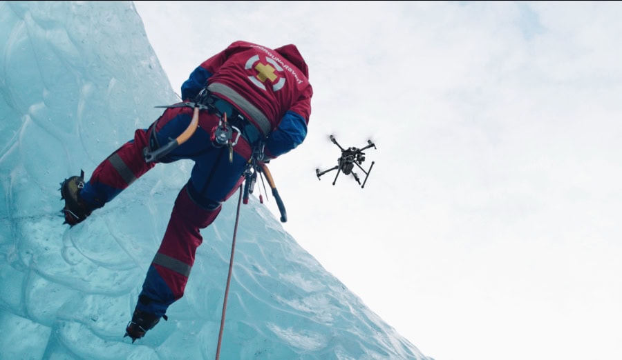
8. High-Angle Rescues
Drones are used to deliver ropes and harnesses to individuals stranded at high elevations or on steep slopes, facilitating rescue efforts in places where traditional climbing methods are risky or impractical.
9. Communication Relay
In areas where communication networks are down, SAR drones can act as temporary communication relays, allowing rescue teams to stay connected and coordinate their efforts effectively.
10. Urban Search and Rescue
In urban environments, drones navigate through buildings and rubble to search for trapped victims, assess structural integrity, and provide real-time data to responders on the ground.
11. Search and Rescue in Dense Forests
Equipped with infrared sensors, drones can locate individuals in dense forests by detecting body heat, making them invaluable for search missions in heavily wooded areas where visibility is limited.
12. Avalanche Search
Drones are used to search for avalanche victims, providing quick aerial assessments of the snowpack and identifying areas where victims might be buried. This speeds up the search process and increases the chances of finding survivors.
13. Search in Confined Spaces
Specialized drones are used to navigate confined spaces such as caves, mines, or collapsed structures to search for individuals. These drones are equipped with lights and cameras to provide visual access in otherwise inaccessible areas.
14. Assessing Structural Damage
Drones provide aerial inspections of damaged buildings and infrastructure, offering detailed imagery to assess safety risks and plan for search and rescue during disasters within collapsed or otherwise compromised buildings.
15. Delivery of Emergency Supplies
In situations where traditional means of transportation are hindered, drones can deliver essential supplies such as food, water, and medical kits to stranded individuals or areas inaccessible by road.
Law Enforcement Drones: Case Studies and Real-World Examples
Now that we’ve explored the various applications of SAR drones, let’s dive deeper into some real-world examples of how search and rescue teams are using these drones to save lives and make their operations more efficient.
Texas A&M Engineering Extension Service (TEEX)—Texas

Credit: TEEX
The TEEX Urban Search & Rescue (USAR) teams have been using drones to enhance their disaster response capabilities. In 2018, following Hurricane Harvey, TEEX deployed drones to assess flood damage and locate stranded individuals in the aftermath of the storm.
The drones were instrumental in providing aerial views of affected areas, which helped coordinate rescue efforts and deliver supplies to isolated communities.
Learn more about TEEX’s drone program:
UK Search and Rescue Teams—United Kingdom

Credit: UK Maritime and Coastguard Agency
In the UK, drones have become a vital part of search and rescue operations. The Maritime and Coastguard Agency uses drones to search for missing persons along the coastlines and in remote areas. In 2020, drones were used in a high-profile search for a missing hiker in the Scottish Highlands.
The drones covered large areas of difficult terrain, providing thermal imaging and live video feeds that greatly enhanced the search operation.
Learn more about UK SAR drone operations:
New York State Police—New York, NY
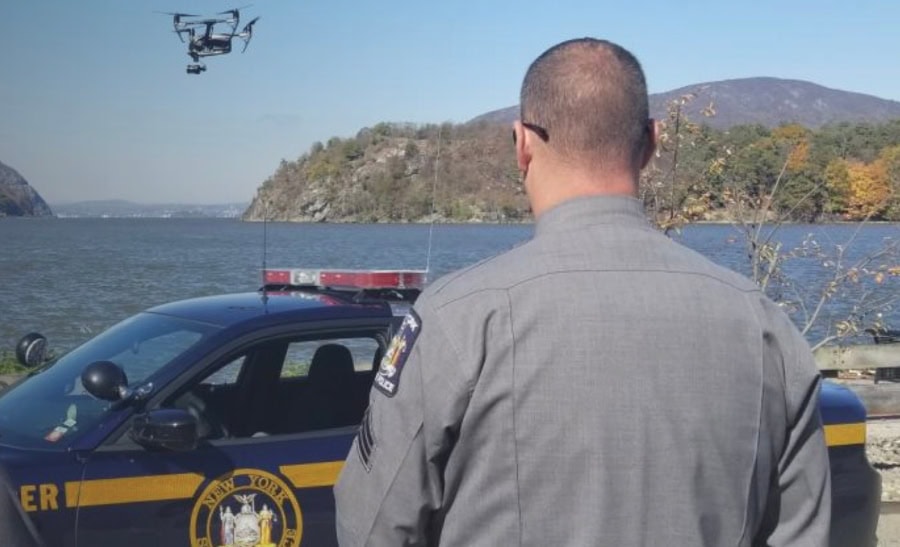
Credit: New York State Police
The New York State Police have utilized drones for a variety of SAR missions. In one notable case in 2019, drones were deployed to locate a lost hiker in the Adirondack Mountains. Equipped with thermal cameras, the drones were able to quickly identify the heat signature of the hiker, who was then successfully rescued by ground teams..
Learn more about the New York State Police drone program:
Alpine Rescue—Swiss Alps
In the Swiss Alps, drones have become essential for alpine rescue missions. Teams from Swiss Alpine Rescue use drones to locate lost or injured climbers and hikers in remote and difficult-to-reach areas. In 2022, drones were used to find and rescue a group of climbers caught in an avalanche. The drones’ thermal imaging capabilities and ability to fly in harsh weather conditions made them invaluable tools for the rescue operation.
Learn more about Swiss Alpine Rescue’s use of drones:
The Future of Drones in Search and Rescue
As you can see, the integration of drones into SAR operations has already revolutionized the field.
But, in many ways, we’re just getting started when it comes to the potential impact drones could have in helping save people’s lives.
Here are 7 trends on the forefront of drones in search and rescue.
1. Drone as First Responder (DFR) Programs

Credit: The City of Fremont
Drone as First Responder (DFR) programs have primarily been utilized in law enforcement, but they are beginning to make significant strides in search and rescue operations as well.
For instance, the dual police/firefighting DFR program in Fremont, CA, has demonstrated the efficacy of drones in rapidly responding to emergencies. The success of these programs suggests a future where drones are a standard part of SAR response, capable of being dispatched instantly to assess situations, locate victims, and provide crucial information to ground teams.
As more SAR teams recognize the benefits of rapid drone deployment, the adoption of DFR programs is expected to expand.
2. AI-Powered Search and Rescue Drones
Artificial intelligence (AI) is set to play a major role in the next generation of SAR drones.
AI-powered SAR drones are capable of analyzing vast amounts of data in real-time, allowing them to identify patterns and anomalies that might indicate the presence of missing persons or hazards. Using AI, drones can autonomously scan large areas, differentiate between humans and animals, and even predict the potential movement patterns of lost individuals.
The integration of AI has the potential to create optimal flight paths, reducing the time it takes to locate missing persons and increasing the chances of a successful rescue. These drones can also learn from past missions, continually improving their performance and reliability in SAR operations.
3. Drone Swarms for Large-Scale Operations
Drone swarms—a team of multiple drones working together in a coordinated manner—are poised to revolutionize SAR operations.
These swarms can cover large areas more quickly than individual drones, providing extensive aerial surveillance and mapping capabilities. Researchers are developing algorithms that enable drones to communicate and cooperate, sharing data and adapting to dynamic conditions on the fly.
This technology is particularly promising for large-scale disasters, where rapid and comprehensive coverage is essential. Swarms can quickly identify and map critical areas, locate victims, and relay information to SAR teams in real-time, significantly improving the efficiency of search and rescue efforts.
4. SAR-Specific Drone Technology
Credit: Flyhound
As drone technology continues to develop it’s becoming more and more specialized.
And that’s a good thing. Right now BRINC makes several drones just for law enforcement, and there are drones in the works made specifically for firefighting. And it wouldn’t be surprising if we also see researchers develop drones just for search and rescue.
Further, we’re already starting to see companies develop viable technology to support drone rescue missions. One of the best examples is Flyhound, a company that’s developed a drone-mounted module that uses radio signals to find missing people.
As drone technology continues to advance, SAR drones will become even more integral to emergency response, providing critical support in saving lives and enhancing the safety and effectiveness of rescue operations.


