The 5 Best Places to Fly A Drone in Louisville (2024)
A list of the best places to fly your drone in Louisville, Kentucky.
In this article, we’ve scouted out the best places to fly a drone in Louisville, Kentucky.
If you live in (or are traveling to) Louisville, please use this page as a resource to better understand not just where to fly, but also where it’s legal and illegal to fly a drone. We provide guidance on regulations to help you stay compliant with both federal and local rules.

A Sectional Chart of the airspace surrounding Louisville, KY. Source: VFR Map
Louisville Drone Laws — Recreational vs. Commercial
The first thing to understand about flying a drone in Louisville (or any city for that matter) is that under federal FAA regulations, you are either operating recreationally or commercially.
- Recreational drone pilots fall under the FAA’s recreational flyer rules, which are laid out here. Make sure your aircraft is registered and you complete The Recreational UAS Safety Test (TRUST), which are both required by the FAA.
- Commercial drone pilots fall under the FAA’s Part 107 regulations, which require passing a multiple-choice test and becoming an FAA-certified drone pilot. More information on the drone certification process over here.
Drone operators are no longer required to independently contact air traffic control when flying within five miles of an airport. Instead, both recreational and commercial flyers can use the automated LAANC system to request airspace authorization to fly in controlled airspace around and above many airports. If you’re operating in Class B, C, D, or E controlled airspace, you’ll need to request airspace authorization. You may do this through LAANC or through FAADroneZone in areas where LAANC is not available.
When we list locations below, we’ll share whether they sit in controlled or uncontrolled airspace.
Get up-to-date airspace information, including temporary flight restrictions, using free apps like Aloft , Autopylot , or B4UFLY .
Interested in becoming an FAA-certified drone pilot so you can operate under the Part 107 regulations and make money flying your drone? Check out our industry-leading, online training course over at Drone Pilot Ground School.
So those are the federal rules.
But what about local Louisville drone laws?
Here’s a guide we put together for drone laws in Kentucky. Make sure to consult that to see if there are any local drone ordinances you should follow in Louisville. When in doubt, use good judgment and follow the FAA’s guidelines.
Note: The content on this page is meant for informational purposes only and is not meant to take the place of legal counsel. If we missed something, or if you have further questions, please send an email to support[at]horizonap[dot]com, and we’ll do our best to help you out.
Where to Fly a Drone in Louisville
Alrighty—without further ado, here are our top picks for the best places to fly a drone in the Louisville area. We selected these locations based on airspace restrictions, accessibility, and attractions. You’ll find that most of the locations we’ve chosen are located in uncontrolled, Class G airspace where you don’t need to request permission to fly. Additionally, we made sure to highlight any locations with designated sUAS/remote aircraft fields.
1 — Waterfront Park
401 River Rd, Louisville, KY 40202
- Airspace Class: Class G — Uncontrolled
- Airspace Map: https://b4ufly.aloft.ai/?lat=38.258734&long=-85.748005
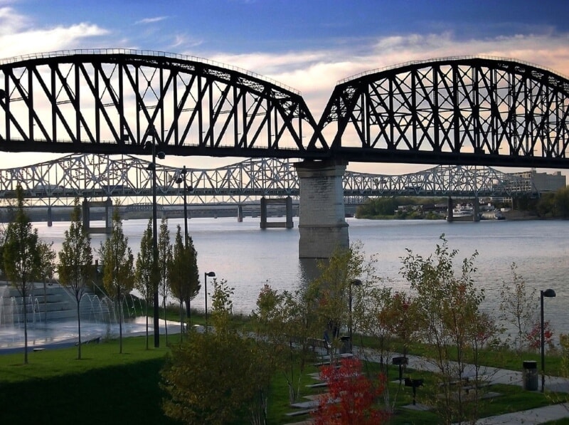
Waterfront Park is located along the Ohio River in Louisville, Kentucky. The expansive open green space features a stunning view of the John F. Kennedy Memorial Bridge and the Abraham Lincoln Bridge. The various structures that span over the river are lit by colored LED lights that create an epic backdrop as the colors reflect off the water. Drone pilots will also enjoy downtown views and ships passing on by. It is important to note that Class C controlled airspace starts just south of the park, always remain vigilant of air traffic.

Source: Flickrized
2 — Shawnee Park
4501 W Broadway, Louisville, KY 40211
- Airspace Class: Class G — Uncontrolled
- Airspace Map: https://b4ufly.aloft.ai/?lat=38.259403&long=-85.830024
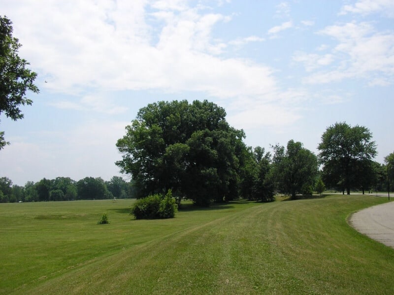
Shawnee Park is a wide-open green area located on the banks of the Ohio River in Louisville, Kentucky. This impressive property spans over 284 acres which provides ample room for flying a drone. The nearby Duke Energy Gallagher Power Plant also adds an interesting industrial feel with the towering smokestacks. It is important to note that drones cannot be flown directly over the power plant. Drone pilots will enjoy the unique property and scenic views of the surrounding area.

Source: W. marsh
3 — Long Run Park
- Airspace Class: Class G — Uncontrolled
- Airspace Map: https://b4ufly.aloft.ai/?lat=38.266894&long=-85.419053
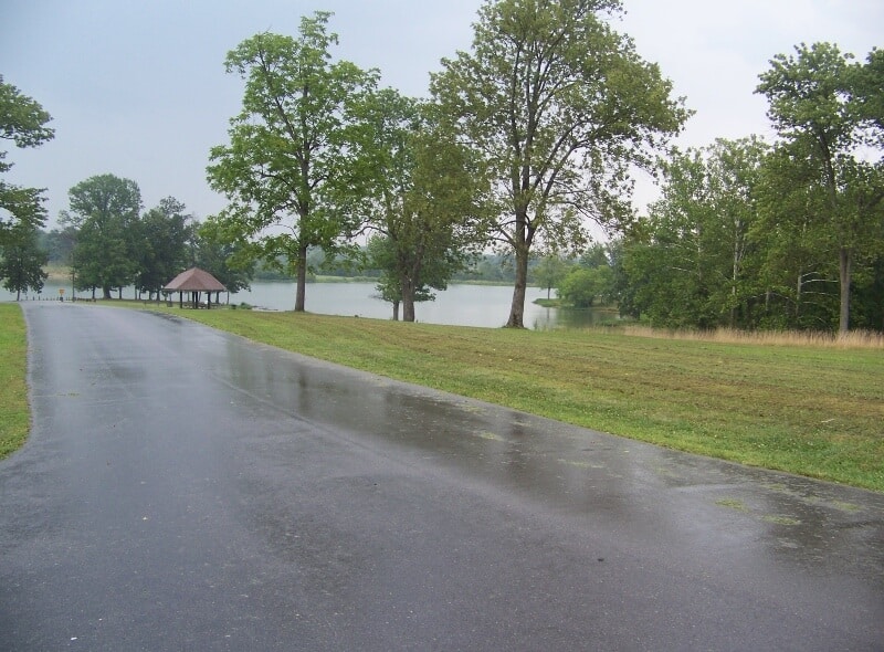
Long Run Park is located next to the Long Run Golf Course in Louisville, Kentucky. It features a beautiful lake that is surrounded by mature trees, open fields, and a walking path. The park is popular among locals because of its serene setting that provides a nice escape from the city. The picturesque property provides the opportunity to frame up that picture-perfect shot.

Source: STONE8HENGE
4 — Jefferson Memorial Park
11311 Mitchell Hill Rd, Fairdale, KY 40118
- Airspace Class: Class G — Uncontrolled
- Airspace Map: https://b4ufly.aloft.ai/?lat=38.084737&long=-85.767932
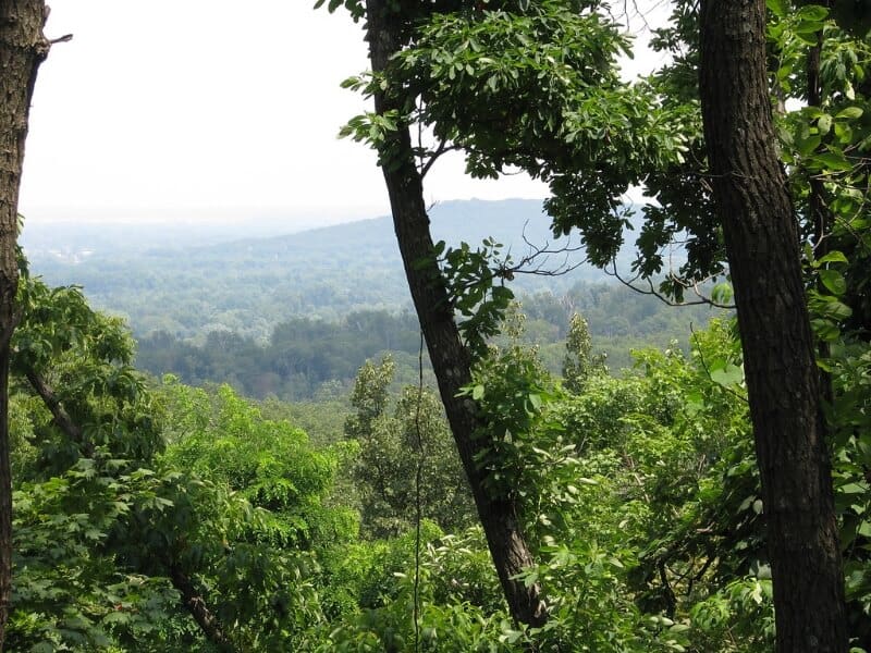
Jefferson Memorial Park is a nature preserve located in Fairdale, Kentucky. The forest is a tribute to veterans, but its remarkable views are truly a gift to everyone who visits the park. Spanning over an astounding 6,500 acres, this location presents various subjects for aerial photography and videography. Soaring oak trees, steep slopes, a lake, and streams that cascade through the forest alongside the trails create an incredible environment.

Source: Jason Meredith
5 — Taylorsville Lake
1320 Park Rd, Mt Eden, KY 40046
- Airspace Class: Class G — Uncontrolled
- Airspace Map: https://b4ufly.aloft.ai/?lat=38.027183&long=-85.270449
Taylorsville lake is located within Taylorsville Lake State Park in Eden, Kentucky. The reservoir was built in 1974 to minimize flooding. At over 18.5 miles long and a surface area of 3,050 acres, there is an abundance of scenic views that any drone pilot would enjoy. The rolling hills surrounding the water and the diverse wildlife population create an unforgettable landscape.