Flyability Releases the Elios 3, An Indoor LiDAR Drones that Makes 3D Maps in Real Time
BY Zacc Dukowitz
19 May 2022Today Flyability launched the third generation of its caged indoor drone, the Elios 3.
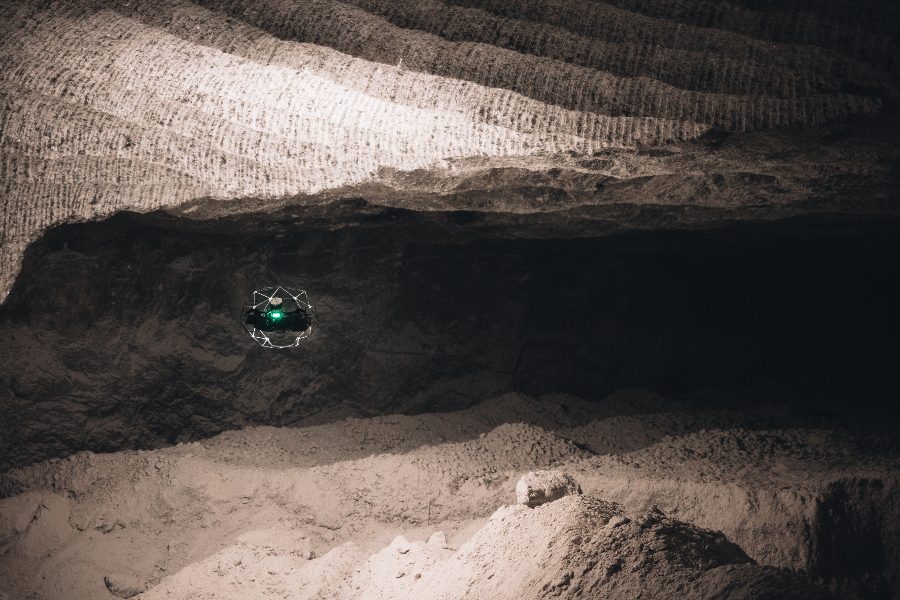
Flyability has been working on the Elios 3 for four years, working to create a new version of its indoor drone that will be even more reliable and provide inspectors with even more types of data than is possible with the Elios 2.
The Elios 3 has some of the very best stabilization in the world, a modular payload, the ability to create 3D models in real time while in flight, and it paves the way towards an increasingly autonomous future. For industrial inspections, the Elios 3 is a key enabler of Industry 4.0, presenting an inspection solution that can make inspections safer, more efficient, and less expensive than ever before.
– Patrick Thévoz, co-founder and CEO of Flyability
Here are some of the biggest updates from the Elios 2 to the Elios 3:
- New LiDAR sensor. The Elios 3 is equipped with a LiDAR sensor made by Ouster, which allows it to collect data to support the creation of detailed 3D models.
- FlyAware. The Elios 3 is powered by a new engine called FlyAware that incorporates LiDAR and visual data to make it incredibly stable while in flight and supports the creation of 3D models in real time, while the drone is in flight.
- Ease of use. The Elios 3 is reportedly so easy to use that pilots who have never flown before can pick up the controller for the first time and perform an inspection flight in the same day.
- Modular payload. In addition to the LiDAR payload, the Elios 3 can carry a second payload, potentially making it a flexible platform for users to collect the specific types of data they need.
- Inspector 4.0. The launch of the Elios 3 is accompanied by a new iteration of Flyability’s inspection software, called Inspector. The biggest update here is that inspectors can now create 3D reports showing exactly where defects found in an asset are located in a 3D model.


Credit: Flyability
Live 3D Mapping
One of the most exciting features of Flyability’s new drone is that it can create 3D maps in real time, while in flight.
This feature is enabled by the addition of a LiDAR sensor to the caged drone setup we’ve all come to know from Flyability. The LiDAR data the Elios 3 collects is processed with a unique algorithm that uses SLAM technology, allowing it to create 3D models while in flight.
SLAM stands for Simultaneous Localization and Mapping, and it’s a mapping method that allows drones and other types of robots to create 3D maps and place themselves within them—in real time.
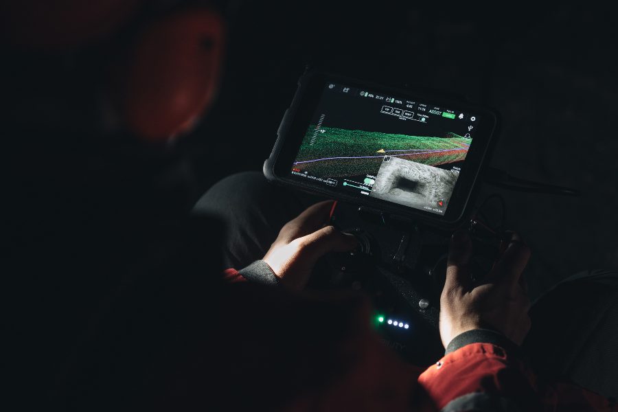
You might think that these 3D models would be fairly sparse, but they’re actually pretty robust. Here’s an example of what a pilot sees on they’re tablet using the new 3D Live Map feature on the Elios 3:


Credit: Flyability
Here’s how the 3D Live Map feature works:
- While airborne, the LiDAR sensor on the Elios 3 acts as a centimeter-accurate indoor GPS, sensing the drone’s surroundings.
- FlyAware then uses this information to produce, in real time, a cumulative 3D Live Map of the asset under inspection, empowering pilots with exceptional locational awareness.
More than just an impressive feature, these 3D models can be used by inspectors to locate themselves within the asset they’re inspecting, allowing them to quickly find their way back or to orient themselves in relation to a defect they find.
And for those flying in confined spaces, this kind of orientation can be hugely beneficial.
Why? Because almost any mission that a pilot undertakes with an indoor drone will be BVLOS (Beyond Visual Line of Sight). By definition, indoor drones are made to fly inside areas that are too inaccessible or dangerous for people to enter, which means that the pilot can’t see the drone while it’s flying.
Flyability’s Elios 2 allows inspectors to fly inside these areas and navigate using a live visual feed. And now, with the Elios 3, inspectors will also be able to use live 3D mapping to better understand their surroundings.
In addition to live 3D maps, inspectors can use the LiDAR data they collect with the Elios 3 to create survey-grade 3D models after their missions with software from Flyability’s new partner GeoSLAM. Here’s a 3D fly through of a “no go” zone in a decommissioned nuclear plant created with LiDAR data collected by the Elios 3:


Watch this video on YouTube
The Work that Went into the Elios 3
Engineers at Flyability began working on the Elios 3 four years ago.
Since then, the company has spent thousands of hours in R&D work and conducted over 200 missions in the field to create the next drone in its Elios series.
The Elios 3 is the single biggest project that Flyability has ever undertaken. If you think of the Elios 2 as your classic flip phone, only designed to make phone calls, the Elios 3 is the smartphone. It’s made to be customized for the specific demands of each user, letting you attach the payload you need so you can use the tool as you like, and allowing it to grow and improve over time with new payloads or software solutions.
– Adrien Briod, CTO of Flyability
As part of the effort to make the Elios 3, Flyability collaborated with top universities around the world by joining Team Cerberus. That team was formed to compete in DARPA’s massive, multi-year Sub-T challenge for autonomous robotics in underground environments—a challenge that it ultimately won.


Credit: Flyability
In speaking with Flyability personnel about the Elios 3, one point that comes up often is that it’s a platform made to grow over time.
This aspect of the drone is highlighted by its modular payload, which will allow inspectors in different industries to attach new sensors as Flyability develops the ability to incorporate new types of data into its workflow. It’s also reflected in the drone’s being “ready for autonomy”—a phrase that means it’s not autonomous yet, but it could be before too long.
For Flyability, the long term vision for the Elios 3 is to have a solution similar to a drone-in-a-box, which can deploy autonomously, collect inspection data inside assets, and then return home to offload its data.
Though that future may still be a ways off, the Elios 3 that launched today is an impressive platform.
Want to learn more? Watch the Elios 3 launch video that Flyability shared today:


Watch this video on YouTube


